
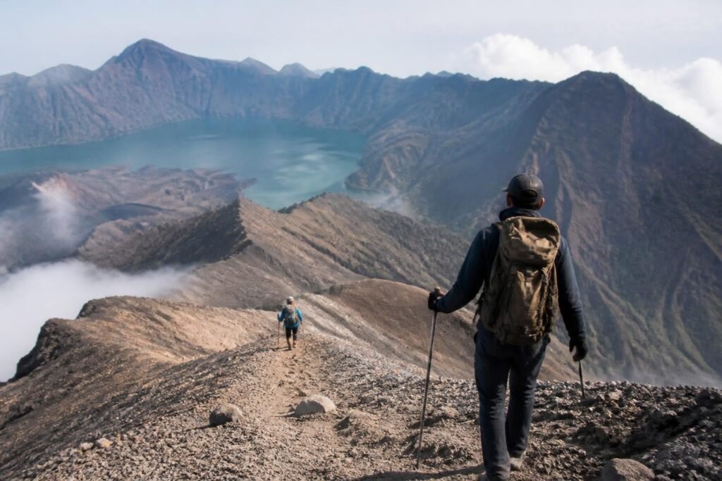
Mount Rinjani stands as one of Indonesia's most spectacular trekking destinations, offering adventurers multiple routes to explore its volcanic landscape. The rinjani trails wind through diverse terrain, from dense rainforest to barren volcanic rock, each path presenting unique challenges and rewards. Understanding these trails is essential for planning a successful expedition to the 3,726-meter summit or the stunning Segara Anak crater lake. Whether you're a first-time trekker or experienced mountaineer, knowing the characteristics of each trail helps ensure a safe and memorable journey through this remarkable national park.
Understanding the Primary Rinjani Trails Network
The trail system on Mount Rinjani has evolved significantly over recent years, with new routes opening and older ones being refined for better sustainability and safety. Each rinjani trail offers distinct advantages depending on your fitness level, available time, and trekking objectives.
Senaru Trail: The Classic Northern Approach
The Senaru trail represents the most established route up Mount Rinjani, starting from the village of Senaru on the mountain's northern slopes. This path has served trekkers for decades and remains popular for its well-maintained infrastructure and spectacular views.
Key characteristics of the Senaru trail:
- Starting elevation: 601 meters above sea level
- Distance to crater rim: approximately 8.5 kilometers
- Average trekking time to crater rim: 7-8 hours
- Grade: Moderate to challenging
- Water sources: Multiple points along the route
The Senaru approach passes through diverse ecosystems, beginning in lush tropical forest before transitioning to montane vegetation and eventually reaching the sparse alpine zone. Trekkers encounter several rest posts along the way, including Pos 1, Pos 2, and Pos 3, each offering designated camping areas and basic facilities.
Sembalun Trail: The Eastern Gateway
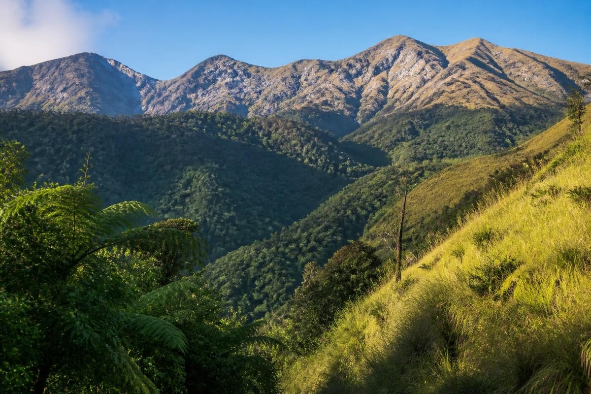
The Sembalun trail starts from Sembalun Lawang village on the eastern side of Mount Rinjani, offering a completely different trekking experience compared to Senaru. This route is particularly favored by those attempting the summit.
| Trail Feature | Sembalun Route | Senaru Route |
|---|---|---|
| Starting Elevation | 1,156 m | 601 m |
| Initial Terrain | Open savanna | Dense forest |
| Sun Exposure | High | Moderate |
| Water Availability | Limited initially | Regular sources |
| Summit Access | More direct | Longer approach |
The Sembalun trail's higher starting point means trekkers begin with less elevation gain, though the exposed terrain can be challenging under the midday sun. The path crosses vast grasslands offering panoramic views of the surrounding landscape before ascending through steeper sections toward the crater rim.
Torean Trail: The Newest Addition
Since 2021, the Torean trail has emerged as an exciting alternative, quickly gaining popularity among both domestic and international trekkers. This relatively new route offers a fresh perspective on the rinjani trails system and has been carefully developed to reduce environmental impact on older routes.
The Torean approach features:
- Dramatic canyon-like formations reminiscent of prehistoric landscapes
- Less crowded conditions compared to traditional routes
- Well-planned rest stations with improved facilities
- Enhanced safety features and clearer trail marking
One significant advantage of the Torean trail is its design, which incorporates modern trail-building techniques to minimize erosion and environmental degradation. The route provides access to unique geological formations and viewpoints not visible from other rinjani trails.
Many experienced trekkers choose the 3D2N RINJANI SUMMIT package via Torean to experience these spectacular landscapes while reaching the summit and visiting Segara Anak Lake.
Timbanuh Trail: The Western Alternative
The Timbanuh trail on Mount Rinjani's western flank sees less traffic than the main routes but offers solitude and pristine natural beauty. This path is particularly suitable for trekkers seeking a quieter experience away from the busier Senaru and Sembalun routes.
Starting from Timbanuh village, this trail requires more self-sufficiency and experience:
- Limited infrastructure compared to main trails
- Fewer water sources requiring careful planning
- More technical sections demanding navigation skills
- Remote camping locations with minimal facilities
- Spectacular untouched forest environments
Trail Difficulty Levels and Physical Requirements
Understanding the physical demands of different rinjani trails helps trekkers choose appropriate routes and prepare adequately. Each trail presents varying challenges based on elevation gain, terrain type, and distance.
Assessing Your Fitness Level
Beginner-friendly options:
- Crater rim treks via Senaru (2 days, 1 night)
- Lower elevation objectives
- Shorter daily trekking hours
- Less technical terrain
Intermediate challenges:
- Complete crater rim to lake descents
- Multi-day treks with moderate daily distances
- Mixed terrain requiring basic mountaineering skills
Advanced expeditions:
- Summit attempts from any trail
- Extended multi-day treks combining routes
- Technical sections requiring stamina and experience
The crater rim represents an achievable goal for moderately fit trekkers, sitting at approximately 2,639 meters elevation. From there, descending to Segara Anak Lake adds significant distance and knee-jarring downhill sections, while summit attempts demand excellent cardiovascular fitness and mental determination.
Seasonal Considerations for Rinjani Trails
Trail conditions vary dramatically throughout the year, directly impacting safety, enjoyment, and success rates. The rinjani trails operate on a seasonal schedule aligned with weather patterns and environmental protection measures.
Optimal Trekking Seasons
| Season | Months | Trail Conditions | Advantages | Challenges |
|---|---|---|---|---|
| Dry Season | April-November | Excellent | Clear views, stable weather | Higher traffic |
| Peak Season | July-August | Very busy | Best weather | Crowded camps |
| Shoulder Season | April-May, Sept-Nov | Good | Fewer crowds, good weather | Occasional rain |
| Wet Season | December-March | Closed | N/A | Safety hazards |
Mount Rinjani National Park officially closes all trails during the wet season due to dangerous conditions including landslides, flash floods, and limited visibility. Planning your trek during the optimal window ensures safer conditions and more enjoyable experiences on the rinjani trails.
Navigation and Trail Markers
Modern improvements to the rinjani trails include enhanced navigation systems making the routes safer and more accessible. Understanding these markers helps trekkers stay oriented and track their progress.
Trail marking systems include:
- Colored ribbons indicating specific routes
- Numbered posts showing distance and elevation
- Directional signs at major junctions
- GPS coordinates at key landmarks
- Emergency markers for rescue coordination
Despite these improvements, hiring experienced guides remains strongly recommended. Professional guides from Hiking Mount Rinjani possess intimate knowledge of trail conditions, weather patterns, and emergency protocols that significantly enhance safety and success rates.
Water Sources and Hydration Planning
Water availability varies significantly across different rinjani trails, making hydration planning essential for safe trekking. Understanding where and when you'll find water sources influences pack weight and daily strategy.
Senaru Trail Water Points
The Senaru route offers relatively consistent water access:
- Pos 1 (Pondok Pemantauan): Reliable spring water
- Pos 2 (Montong Satas): Stream access during dry season
- Pos 3 (Mondokan Lolak): Limited sources, carry extra
- Crater Rim: No natural sources, rely on carried water
- Segara Anak Lake: Abundant but requires purification
Sembalun Trail Water Availability
The Sembalun approach presents different challenges:
- Initial sections have limited water until Pemantauan post
- Center post offers reliable spring water
- Crater rim requires carrying sufficient supplies
- Summit attempts need careful calculation of water needs
Water purification tablets or filters are essential equipment for all rinjani trails, as untreated water from streams and springs can cause illness that quickly ends a trek.
Camping Locations Along the Trails
Strategic camping locations dot the rinjani trails, providing designated areas where trekkers can rest overnight. These sites vary in facilities, capacity, and environmental impact.
Major camping zones:
- Senaru Crater Rim: Spectacular sunrise views, cold temperatures, limited water
- Sembalun Crater Rim: Similar conditions with different perspective
- Segara Anak Lakeside: Lower elevation, warmer temperatures, swimming access
- Pelawangan II: Summit staging area, very basic facilities
Each camping location operates under capacity restrictions to minimize environmental impact. Peak season bookings require advance planning through registered trekking companies that coordinate with park authorities.
Trail Maintenance and Conservation Efforts
The sustainability of rinjani trails depends on ongoing maintenance and conservation initiatives. Mount Rinjani National Park implements various programs to preserve trail integrity while accommodating trekking tourism.
Recent improvements include:
- Erosion control structures on high-traffic sections
- Designated toilet facilities at major camps
- Waste management systems requiring pack-out policies
- Trail rotation to allow ecosystem recovery
- Porter weight limits protecting worker health
The introduction of the Torean trail partially aimed to relieve pressure on the heavily-used Senaru route, distributing trekker impact across a wider area. These conservation efforts ensure the rinjani trails remain accessible for future generations while protecting the unique ecosystems they traverse.
Connecting Routes and Multi-Day Itineraries
Experienced trekkers often combine different rinjani trails to create comprehensive expeditions exploring multiple facets of the mountain. These connecting routes require careful planning but reward adventurers with diverse perspectives.
Popular combinations include:
- Sembalun to Senaru traverse: Ascend via Sembalun, summit, descend to lake, exit via Senaru (3-4 days)
- Crater rim circuit: Circle the crater visiting both Sembalun and Senaru rims (2-3 days)
- Extended lake stays: Include extra days exploring Segara Anak and hot springs (4-5 days)
- Complete exploration: Summit attempt plus lake visit incorporating multiple trails (4 days)
These extended itineraries allow trekkers to experience the full diversity of environments and landscapes that make Mount Rinjani such a compelling destination. For those with limited time, focused routes like the 2D1N crater rim trek provide excellent introductions to the mountain's beauty without the commitment of longer expeditions.
Safety Protocols on Rinjani Trails
Safety considerations must remain paramount when tackling any of the rinjani trails. The remote environment, significant elevation changes, and unpredictable mountain weather create genuine risks requiring proper preparation and respect.
Essential Safety Measures
Before starting:
- Register with park authorities through licensed operators
- Undergo health screening for altitude-related conditions
- Verify weather forecasts and trail status
- Confirm emergency evacuation procedures
During the trek:
- Maintain steady pace avoiding overexertion
- Monitor for altitude sickness symptoms
- Stay hydrated and maintain caloric intake
- Follow guide instructions without deviation
- Keep group members within visual contact
Emergency preparedness:
- Carry comprehensive first aid supplies
- Know locations of emergency shelters
- Maintain communication devices where coverage exists
- Understand evacuation routes from each section
Professional guides undergo regular training in wilderness first aid, mountain rescue techniques, and emergency protocols. Their expertise proves invaluable when unexpected situations arise on the rinjani trails.
Equipment Considerations for Different Trails
Trail selection influences equipment requirements, with some routes demanding more technical gear than others. Proper equipment dramatically impacts comfort, safety, and success on the rinjani trails.
| Equipment Category | Crater Rim Trek | Summit Attempt | Extended Lake Visit |
|---|---|---|---|
| Sleeping Bag Rating | -5°C | -10°C | 0°C |
| Trekking Poles | Recommended | Essential | Recommended |
| Headlamp | Required | Essential (pre-dawn) | Required |
| Waterproof Layers | Essential | Essential | Essential |
| Gaiters | Optional | Recommended | Optional |
The summit push typically begins around 2:00-3:00 AM, requiring reliable headlamps, warm clothing, and sturdy footwear capable of handling loose volcanic scree. Lake visits in warmer seasons allow slightly lighter packing, though temperature drops significantly at night even at lower elevations.
Quality equipment rental services through established operators like Hiking Mount Rinjani ensure trekkers access appropriate gear without the expense of purchasing specialized equipment for single-use trips.
Cultural Aspects of the Trails
The rinjani trails hold profound cultural significance for local Sasak and Balinese communities who regard the mountain as sacred. Understanding these cultural dimensions enriches the trekking experience beyond physical achievement.
Local beliefs and practices include:
- Sacred sites: Specific locations used for religious ceremonies
- Full moon pilgrimages: Traditional treks for spiritual purposes
- Offering ceremonies: Rituals performed at Segara Anak Lake
- Environmental taboos: Respect for natural features and wildlife
Trekkers should demonstrate cultural sensitivity by:
- Respecting ceremonial sites and avoiding disturbance
- Following guide instructions regarding sacred locations
- Dressing modestly in villages before and after treks
- Supporting local economies through responsible tourism
- Learning basic Bahasa Indonesia phrases for interactions
The villages surrounding Mount Rinjani, including Senaru, Sembalun, and Torean, derive significant income from trekking tourism. Choosing responsible tour operators ensures economic benefits flow to local communities while maintaining cultural integrity.
Training and Preparation for Rinjani Trails
Adequate preparation separates successful, enjoyable treks from difficult struggles on the rinjani trails. Physical conditioning, mental preparation, and logistical planning all contribute to positive outcomes.
Physical Training Recommendations
Cardiovascular conditioning (8-12 weeks before):
- Progressive hiking with loaded backpack
- Stair climbing or hill repeats
- Running or cycling for aerobic base
- Gradual increase in duration and intensity
Strength training focus areas:
- Leg muscles (quadriceps, hamstrings, calves)
- Core stability for load carrying
- Upper body for trekking pole use
- Balance and proprioception exercises
Altitude acclimatization:
- Consider shorter high-altitude treks beforehand
- Understand symptoms of acute mountain sickness
- Plan appropriate ascent rates
- Know when to descend if symptoms appear
Mental preparation proves equally important, as multi-day treks test psychological resilience through physical discomfort, fatigue, and environmental challenges. Researching the specific rinjani trails you'll tackle helps set realistic expectations and build confidence.
The diverse rinjani trails offer something for every type of adventurer, from first-time trekkers to experienced mountaineers seeking new challenges. Understanding route characteristics, seasonal conditions, and proper preparation ensures safer, more rewarding experiences on this magnificent Indonesian volcano. When you're ready to explore Mount Rinjani's stunning landscapes, Hiking Mount Rinjani provides expert guides, quality equipment, and comprehensive support to make your trekking dreams a reality while respecting the mountain's natural and cultural significance.