Mount Rinjani Elevation – Mount Rinjani is not just another hiking destination, it’s a sacred and legendary mountain that has become a dream for many trekkers worldwide. But before you set your eyes on Rinjani, it’s important to understand two key aspects: its elevation and its official difficulty level in Indonesia.
These two elements play a huge role in shaping your trekking experience. If you are not yet experienced enough, Rinjani’s difficulty grade can become an overwhelming challenge. You don’t want to push yourself too hard and return home mentally exhausted.
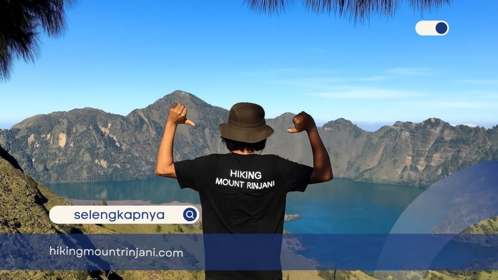
But don’t worry, if you truly want to climb, hikingrinjani.com has the perfect solution. Keep reading until the end to discover how you can overcome these challenges. So, let’s break it down carefully.
Differences Between Mount Rinjani Elevation, Altitude, and Height
When hikers talk about how tall a mountain is, different terms are often mixed up. In fact, each has a different reference point, so they cannot be considered the same. Let’s go through them one by one, using Mount Rinjani as our reference point.
1. Elevation
- Generally, these measurements are viewed in relation to sea level. Refers to a fixed geographical point like a mountain or a village
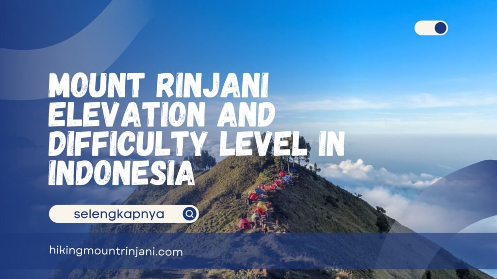
- Example: Elevation is 3,726 meters. That figure represents the height of its summit.
- Usage: The term is usually used for mountains, hills, or any geographical landform measured from sea level.
2. Altitude
- Definition: Is often used for moving objects, such as an airplane, a drone, or even a trekker’s position along the trail.
- Usage: It is often used in aviation and outdoor activities.
3. Height
- Example: “The height of Mount Rinjani from its base is around 2,000 meters.” This means from the foot of the mountain to its peak, the difference is about 2,000 meters.
In the case of Mount Rinjani:
- Elevation: 3,726 meters above sea level.
- Altitude: Your position when trekking (for example, at Pos 3 you’re standing at about 2,000 meters above sea level).
Understanding these three terms helps you appreciate not only the mountain itself but also the way trekking information is presented in official guides or maps. Now you know Mount Rinjani’s elevation, right? Take a moment to reconsider by learning more about its difficulty level below.
Also read: Rinjani Trekking Organizer, Packages, and Latest Prices for 2025
Mount Rinjani Difficulty Level in Indonesia
When planning a hike, elevation is only one side of the story. What truly defines your experience is the difficulty level of the route. In Indonesia, Mount Rinjani has been officially categorized as Grade IV (Heavy/Difficult).
This classification is based on multiple factors: morphology, geography, weather, biological environment, and risk assessment. Let’s break it down:
1. Morphology
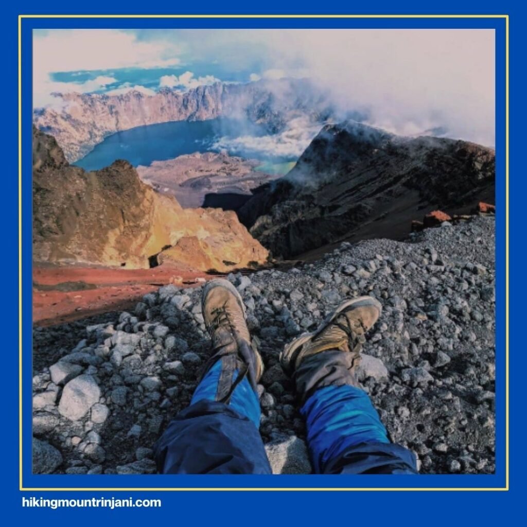
- Trails with slopes greater than 35°.
- Rocky terrain, steep ridges, and long-distance routes (more than 12 km).
- Elevation higher than 3,000 meters.
2. Geography
- Remote access points, which means getting to the starting point requires additional effort.
- Significant natural hazards along the trail.
- Navigation challenges, especially in areas with limited trail markers.
3. Weather
- Rain occurs frequently in certain seasons.
- You may experience temperatures between 10–15°C. Especially as you approach the summit, with the risk of dropping even lower.
- Medium to heavy fog often reduces visibility.
4. Biological Environment & Risk Level
- Wild animals like monkeys, wild boars, and non-venomous snakes may appear, though they usually avoid human presence.
- Vegetation may cause mild irritation or allergic reactions when touched (plants with stinging hairs or thorny bushes).
- Risk level (HIRA Assessment) is considered medium to high (4–7 on the scale), depending on season and preparedness.
Mount Rinjani is a towering giant with an elevation of 3,726 meters, but its real challenge lies in its Grade IV difficulty level. By understanding the differences between elevation, altitude, and height, and by recognizing why Rinjani is officially classified as a difficult trek, you can better prepare yourself mentally and physically.
Also read: Top Rinjani Trekking Agency for Foreign Hikers, Complete!
Why Is Mount Rinjani Elevation Classified as Grade IV (Heavy)?
There are several clear reasons:
- Varied and challenging terrain: Some sections are forested, others are steep, and some are unmaintained, requiring strong stamina.
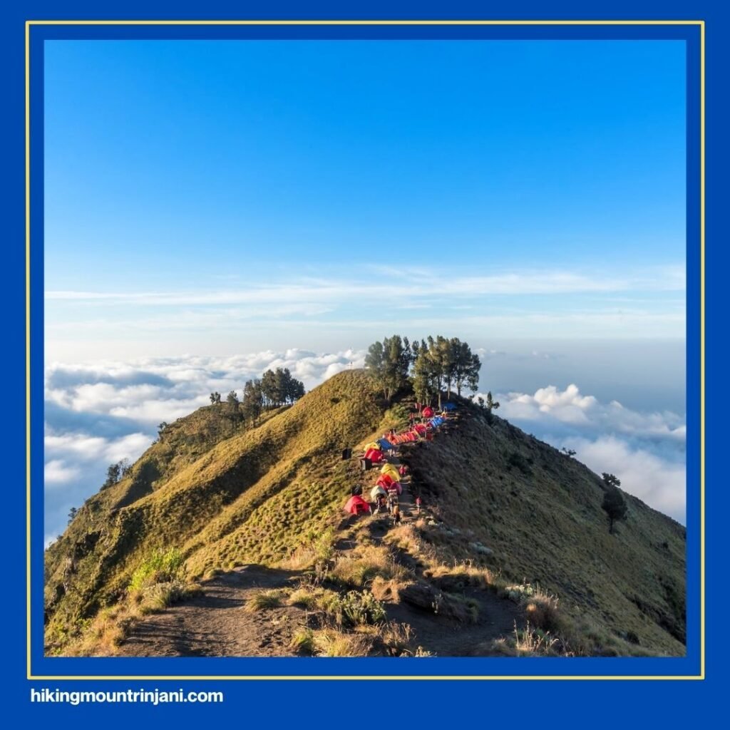
- Multi-day expedition: Trekking Rinjani usually takes 2–4 days, meaning you must plan logistics, food, and camping gear thoroughly.
- Technical aids may be needed: In certain areas, ropes, webbing, or simple climbing gear can be useful for safety.
- Advanced skills required: Hikers should understand navigation, basic survival techniques, and emergency rescue protocols. Evacuation is not easy due to Rinjani’s remoteness.
- Experience matters: It’s strongly recommended only for experienced trekkers who have done several Grade II or III trails before attempting Rinjani.
In short, Rinjani is not for absolute beginners. It demands physical strength, mental preparation, and proper guidance. But for those who are ready, the reward is unforgettable: the sunrise view from the summit, the mystical Segara Anak Lake, and the feeling of conquering one of Indonesia’s most iconic peaks.
For international hikers, Rinjani offers more than just a hike, it’s a test of endurance, survival skills, and respect for nature. And when you finally stand at the summit, looking down at Lombok Island bathed in morning light, every step of the journey feels worth it.
Want to Climb Rinjani Anyway? Go with Hikingmountrinjani.com
If reading about Rinjani’s elevation and difficulty makes you even more excited rather than scared, that’s a good sign, you might be ready! But don’t underestimate this mountain. The safest and most comfortable way is to trek with a trusted organizer.
At Hikingmountrinjani.com, you can book a complete trekking package that includes:
- Licensed local guides and porters.
- Camping equipment and meals.
- Officially registered (so your climb is 100% legal).
- Insurance is already included. In short, your safety and trekking needs are fully guaranteed.
- And of course, at an affordable price.
With Hikingmountrinjani.com, we will make sure you return home safely. You can share with our team what you’ve prepared or any concerns you may have. If we can provide the right solution, that will be a win-win for both of us: you and our team.
If you have questions or are ready to start your trek, don’t hesitate to contact us via WhatsApp. Simply click the button below or check our contact page at Hikingmountrinjani.com.