Where Is Mount Rinjani – If you’ve ever dreamed of standing above the clouds, watching the sunrise cast golden light over a vast crater lake, and feeling the cool breeze of Indonesia’s second-highest volcano. Then Mount Rinjani might already be on your bucket list. But before you pack your hiking boots and book a flight to Lombok, there’s one essential question every traveler should ask: where is Mount Rinjani?
Mount Rinjani (or Gunung Rinjani in Indonesian) is not just a mountain. It’s a sacred peak, a national park, and one of Southeast Asia’s most breathtaking hiking destinations. Located on the island of Lombok, this 3,726-meter volcano is part of the famous Ring of Fire that stretches across Indonesia.
The mountain dominates Lombok’s northern landscape, offering both challenge and serenity for adventurers who seek something more than just a trek. An experience that blends culture, nature, and spiritual wonder.
Unlike Bali’s bustling beaches or Java’s historical temples, Mount Rinjani presents a wilder side of Indonesia. A place where the forest hums with life, local villagers greet you with warm smiles, and the sound of flowing rivers accompanies your steps toward the summit.
Understanding its location and the main entry points will help you plan your climb wisely and make the most of your journey.
Where Is Mount Rinjani?
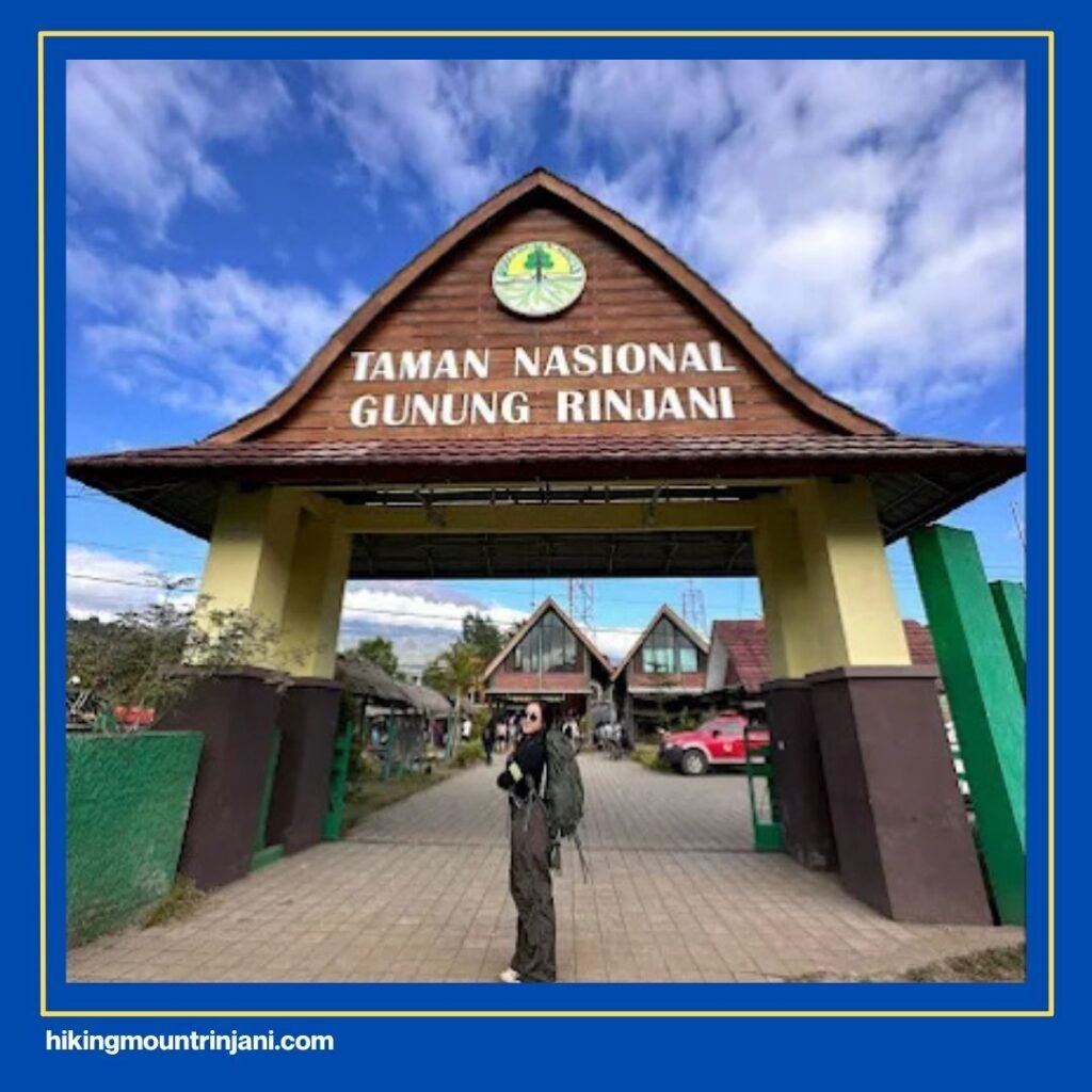
Mount Rinjani is located in North Lombok Regency, West Nusa Tenggara Province, Indonesia. The mountain lies within the Mount Rinjani National Park, which covers approximately 41,000 hectares of protected forest area. It’s part of the island’s northern volcanic chain and visible from many parts of Lombok, and even from Bali on clear days.
The nearest city to Mount Rinjani is Mataram, the capital of Lombok, situated about 80 kilometers from the base of the mountain. If you’re arriving from Bali, the easiest way is by taking a short 30-minute flight or a fast boat to Lombok. Once you arrive at Lombok International Airport (LOP), your journey to Rinjani continues by road, a scenic drive of 2.5 to 3 hours through rural villages and lush hills.
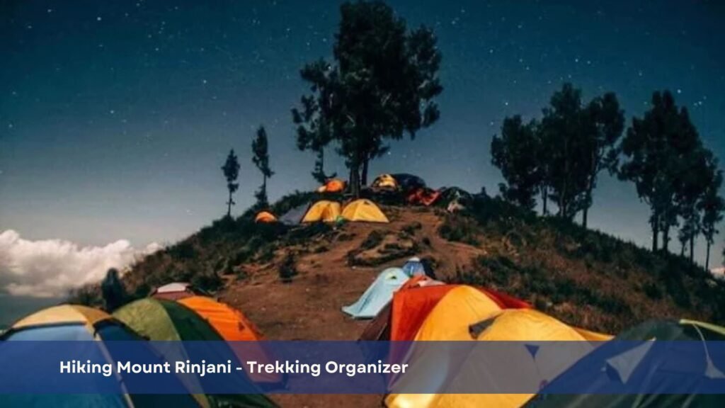
Rinjani’s terrain is diverse, from tropical rainforest and savanna grassland to rocky volcanic slopes. At the top lies Segara Anak, a turquoise crater lake surrounded by cliffs, where a smaller active cone, Gunung Barujari, still emits smoke from time to time. The lake and the summit together create a dramatic landscape that attracts both local and international climbers every year.
.
Read Also: Mt Rinjani Tour Options: Trekking and Non-Trekking for Foreign
2 Main Entry Points for Climbing Mount Rinjani
If you’re planning to climb Rinjani, knowing the two main entry points, Senaru and Sembalun, is crucial. Each route offers different scenery, levels of difficulty, and trekking experiences.
1. Senaru Entry Point
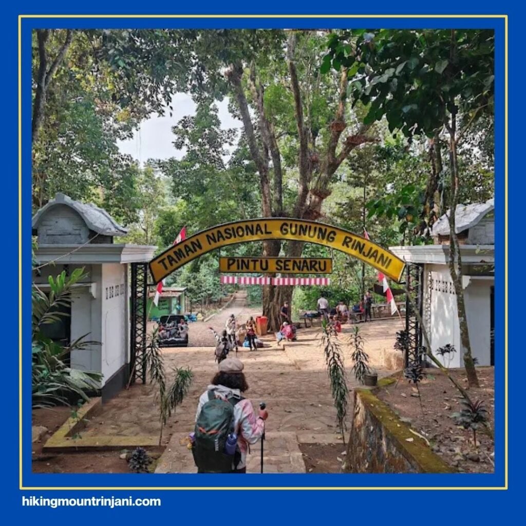
If you choose the Senaru route, your journey begins in Senaru Village, located in North Lombok at an altitude of around 600 meters above sea level. This charming village serves as one of the official gateways to Mount Rinjani National Park. It’s also home to several traditional Sasak houses, small guesthouses, and local eateries where you can rest and prepare before your hike.
From Senaru, you’ll start your trek through dense tropical forest filled with the scent of earth and the sounds of chirping birds and cicadas. The humidity here is high, and the trail is mostly shaded by tall trees. Giving it that untouched, mystical feel that many trekkers love.
Before you reach the first official post, you’ll arrive at Jebag Gawah, a point situated at around 800 meters. This is often considered the “real gate” to the mountain, marking the transition from village terrain to pure wilderness. From there, it’s about 2.5 kilometers to reach Pos 1 (First Post), where most hikers take a short rest and refill water bottles.
The Senaru trail is known for being steep from the very beginning. Unlike the Sembalun route, there are very few flat areas, so pacing yourself is essential. Focus on your breathing, take steady steps, and don’t rush.
The forest canopy may feel endless at times. But once you break out of it, especially as you reach the crater rim (Plawangan Senaru). You’ll be rewarded with one of the most stunning views in Indonesia: the vast blue of Segara Anak Lake nestled inside Rinjani’s caldera.
For many hikers, Senaru is not just a trail. It’s a pilgrimage through nature. You’ll encounter local porters carrying supplies, meet other trekkers from around the world, and feel the raw power of the mountain every step of the way.
2. Sembalun Entry Point
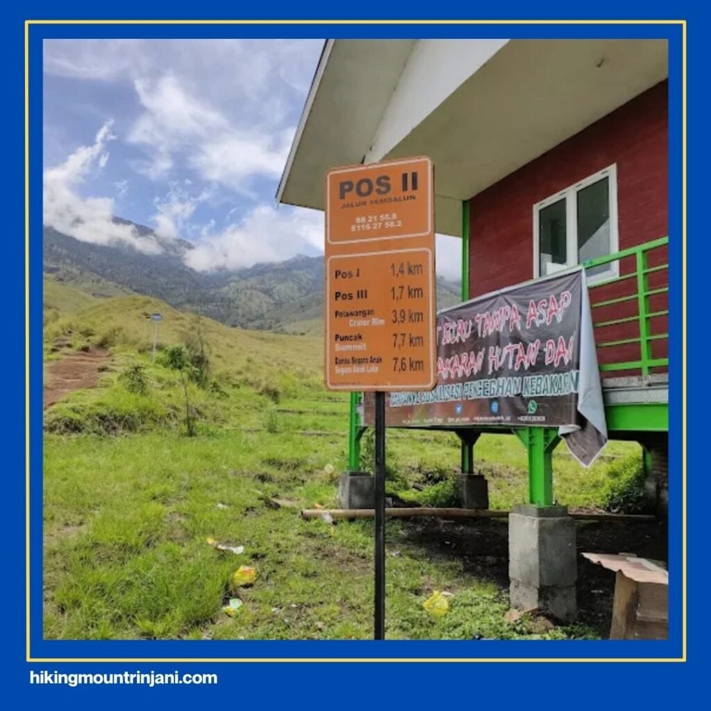
The Sembalun route is the most popular gateway for those aiming to reach the summit of Mount Rinjani. Located in Sembalun Lawang Village, East Lombok, this entry point sits higher than Senaru, at about 1,150 meters above sea level. Which means a slightly shorter climb to the crater rim, but with a more open and exposed landscape.
Sembalun is also home to the Rinjani Information Center (RIC) — the official registration office for climbers. Here, you’ll complete your registration, attend a short safety briefing from the national park officers, and get updates about current trail conditions. Nearby, you’ll also find the Rinjani Volcanology Office, which monitors volcanic activity and weather patterns to ensure climber safety.
The first part of the Sembalun trail leads you through vast grasslands rather than forests. The scenery here is stunningly open, with rolling green hills and wildflowers that sway in the breeze. You’ll likely encounter local farmers and grazing cattle before the terrain begins to steepen after Pos 2. The openness also means more sun exposure, so make sure to wear a hat, sunscreen, and carry enough water.
While Sembalun is easier in elevation gain at the start, it becomes quite challenging near the summit. Especially during the early morning push to the peak, which begins around 2:00 AM. The loose volcanic sand makes every step upward feel like sliding half a step back, but the reward at the top: sunrise over Lombok, Bali, and even Sumbawa. Makes it all worthwhile.
If your goal is to reach the summit, Sembalun is the best route. But if you prefer a more shaded, forested trail with richer natural scenery, Senaru might suit you better. Many hikers choose to start from Sembalun and descend through Senaru, completing a rewarding cross-mountain trek that showcases both sides of Rinjani’s beauty.
.
Read Also: Is Mount Rinjani Harder Than Annapurna? Let’s Compare!
Want to Visit Mount Rinjani from Your Country? Here’s the Route Map
For international travelers, reaching Rinjani is straightforward. Most visitors fly into Lombok International Airport (LOP), located in Central Lombok. From there, your trekking company, usually pre-booked online, will arrange transportation to your chosen entry point, either Senaru or Sembalun. The drive typically takes 2 to 3 hours, depending on traffic and weather conditions.
As of recent regulations, foreign hikers are required to book a guided trekking package through an official operator. This ensures your safety, proper waste management, and contribution to local conservation efforts.
If you haven’t yet found a trusted trekking company, you can contact Hiking Mount Rinjani, an official and experienced trekking organizer established in 2015. Visit their website at hikingmountrinjani.com
for route options, detailed itineraries, and professional guides who can help plan every part of your adventure.
With proper planning, preparation, and respect for the mountain’s natural and cultural significance, your journey to Mount Rinjani will be an unforgettable experience — one that connects you not only to Indonesia’s landscapes but also to the spirit of exploration itself.
Contact Them below:
.